REVIEW · MALTA
Cruise around Malta’s Harbours and Creeks from Sliema
Book on Viator →Operated by Robert Arrigo & Sons · Bookable on Viator
A harbor cruise is a quick shortcut to seeing Malta from the water. This one runs from Sliema Ferries, then winds through creeks and harbors that you would never notice from a bus window. You’ll pass major landmarks and get an English audio track while the boat does the heavy lifting.
Two things I really like: the English audio commentary is clear and tied to what you’re seeing, and the route gives you nonstop variety in a short time.
One consideration: it’s a boat on open water, so if you’re prone to sea sickness or the day is windy, you may want to plan carefully.
In This Review
- Key points before you go
- Why a harbour-and-creek cruise is such a smart Malta move
- Sliema Ferries: the easy starting point that keeps your day flexible
- Sliema Creek: your first lesson in how Malta moves
- Manoel Island: fort history and a quieter shape in the middle of the harbor
- Lazzaretto Creek and the Lazzaretto: quarantine-era Malta
- From the Yacht Marina to Ta’ Xbiex and Msida: the inner-harbor rhythm
- Pieta Creek to Valletta and Floriana: the fort walls make sense from the water
- Grand Harbour panoramas: Valletta’s main gateway in full view
- Marsamxett Harbour and the shipyard creeks: leisure and industry side by side
- The French and Dockyard creeks: a working coastline tour
- The Three Cities from the water: Cospicua, Senglea, and Vittoriosa
- Kalkara and Rinella: quieter creeks before the return to Sliema
- Comfort, seating, and the quality of the English audio
- Price and value: is $24.19 for 90 minutes worth it
- Who should book this (and who should think twice)
- Should you book this harbour-and-creek cruise from Sliema?
- FAQ
- How long is the Malta harbours and creeks cruise from Sliema?
- Where does the cruise depart from?
- Is there a live guide on board?
- What language is the audio commentary?
- Is this cruise good if I get sea sick?
- What should I bring for the trip?
- What happens if the cruise is cancelled due to weather?
Key points before you go
- English PA audio helps you connect each landmark to the view outside your window
- Sliema’s central jetty means an easy walk for coffee, shopping, or a meal before and after
- Manoel Island and Lazzaretto turn a simple harbor ride into a story about quarantine-era Malta
- The Three Cities from the water gives you a better sense of fortifications and scale than photos do
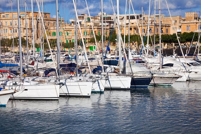
- You can choose your seat for sun or shade, and outside air feels great in warm weather
- Most of the route is visual—you can enjoy it even without long stops on land
Why a harbour-and-creek cruise is such a smart Malta move
Malta’s coast is where the story lives. On land, you can get stuck in one neighborhood, looking at buildings that you can only partly understand. From the water, the geography clicks fast: creeks, breakwaters, fort walls, and harbors all make sense in relation to each other.
This cruise is also a timing win. At about 1 hour 15 minutes to 1 hour 30 minutes, you get a real circuit without eating up your whole day. And because it starts back in Sliema, it’s easy to pair with the promenade, dinner, or a quick stroll through town.
The value is tied to how much you can see for the money. For $24.19 per person, you’re paying for guided-style context (via audio) plus a viewpoint upgrade. It’s not an all-day sightseeing mission. It’s a focused water tour that works especially well if you have limited time.
You can also read our reviews of more tours and experiences in Malta.
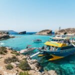
Sliema Ferries: the easy starting point that keeps your day flexible
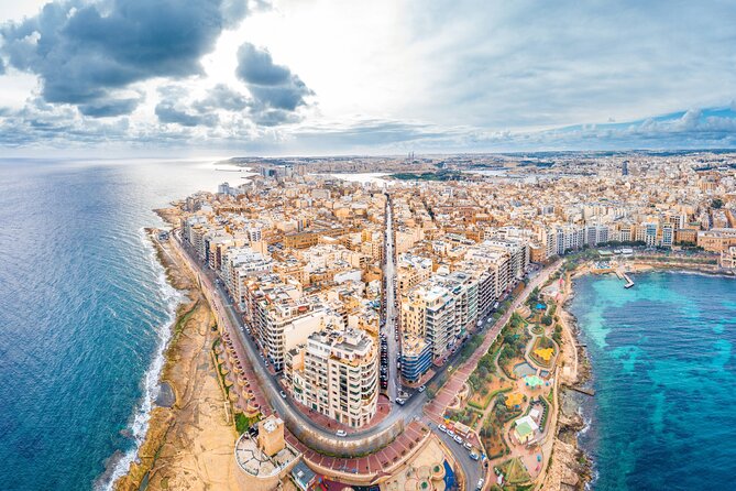
The departure point is Ferries 4Malta near the center of Sliema. From there, you cruise through Sliema Creek and then work your way around Marsamxett Harbour and the Grand Harbour before returning.
Why this matters for you: the jetty location is convenient. After the trip, you’re basically dropped in the middle of activity—so you can walk the promenade, grab a coffee, or browse shops without needing taxis or extra planning. That’s a small detail, but it saves time and makes the whole outing feel less like an isolated ticket and more like part of your Malta day.
If you’re staying in Valletta, the quick ferry hop to Sliema can also be a nice add-on. One practical tip: start looking early for the correct boarding boat. The pier has multiple tour boats, and signage for the exact one isn’t always obvious at first glance.
Sliema Creek: your first lesson in how Malta moves
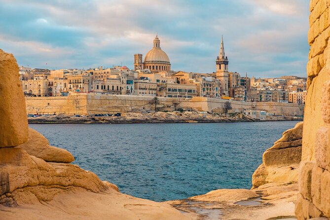
Sliema Creek is your launchpad. It’s a busy waterway where harbor cruise boats operate constantly. Expect a lively mix of tour craft and local marine traffic. That activity is useful. It tells you right away that Malta’s waterways aren’t just scenery—they’re the working veins of the coastline.
What you’ll enjoy most here is the contrast between “busy water” and “short walk city.” While the boat is in motion, you’re also near Sliema’s center. That means you can arrive, do the cruise, and then step straight into the restaurants and shops nearby.
If you’re sensitive to choppier conditions, this is where you’ll first feel the weather. On breezy days, the air can be stronger on the water than you expect—so think about layers. Even if the forecast says warm, the boat can feel cool once you’re moving.
Manoel Island: fort history and a quieter shape in the middle of the harbor
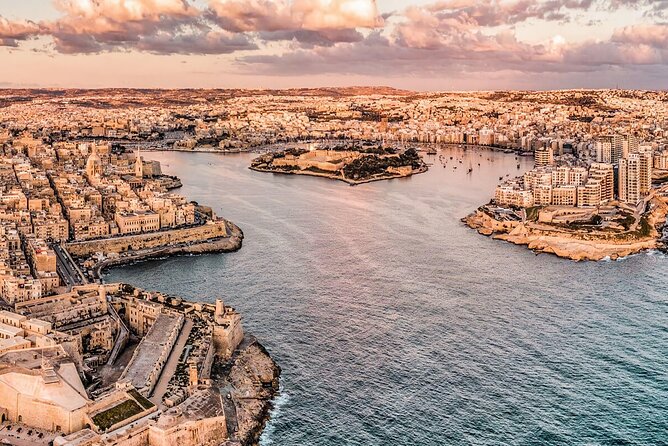
Next comes Manoel Island, a small, flat island with a distinct leaf-like shape. It sits in Marsamxett Harbour and is connected to the mainland by a bridge. Historically, it’s been known by names like Bishop’s Island and the Isolotto, and it’s named for Grand Master António Manoel de Vilhena, who built a fort there in the 1720s.
From the water, Manoel Island reads differently than it does on land photos. The island’s position in the middle of the harbor makes it feel like a landmark placed to control the water route. And it also ties into what you’ll see later in Valletta—because the island can be viewed from the bastions of the capital.
This stop is a good moment to slow down mentally. Let your eyes get used to Malta’s coastline pattern: hard fortifications, calm pockets of water, and then sudden angles where a creek cuts in.
Lazzaretto Creek and the Lazzaretto: quarantine-era Malta
The route then passes through Lazzaretto Creek and near the Lazzaretto on Manoel Island. This is the kind of place you don’t get to linger at on most vacations, which makes it perfect for a cruise format.
Here’s what’s worth knowing before you look:
- It was a quarantine facility and hospital
- The complex includes buildings dating from the 17th and 19th centuries
- Most structures still exist, but they’re in rough shape, damaged during World War II and abandoned for over 30 years
- Restoration is planned
Even without walking around, you’ll be able to spot why the Lazzaretto matters. It’s proof that Malta’s harbors weren’t only about trade and defense—they were also the front line of public health in an era when diseases traveled with ships.
If you like places with a clear purpose, this is one of the most meaningful segments of the cruise.
From the Yacht Marina to Ta’ Xbiex and Msida: the inner-harbor rhythm
After Manoel Island, the boat passes the Manoel Island Yacht Marina, then heads through Ta’ Xbiex Creek and Msida Creek, before continuing to Pieta Creek.
This stretch is about texture. You’re moving through parts of the water system that feel more recreational and local than the main “big harbor” views. You’ll also notice how creeks frame different shorelines—small breaks, harbor edges, and the way water traffic shifts as you move from one basin to the next.
A practical detail that can help your experience: Msida Creek is easy to identify by a breakwater on the starboard side as you enter. That means if you pay attention early, you can start “reading” the route while you’re on it. It turns the cruise from passive watching into active spotting.
Pieta Creek to Valletta and Floriana: the fort walls make sense from the water
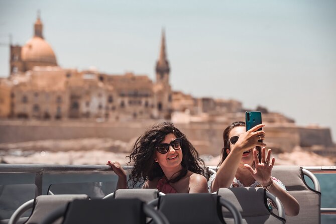
As the cruise continues, you pass by the battlements and fortifications surrounding Valletta and then the imposing defenses around Floriana.
From street level, you can see walls but still miss the logic. From the water, those defenses look more purposeful. The fortifications line up with sightlines across the harbor. You see how the shoreline and the defensive geometry work together—especially when your boat is moving parallel to the walls.
This is also when the views start feeling bigger. The capital city becomes a kind of backdrop made of stone and layers. If you’ve been walking in Valletta, this water pass lets you reframe what you already saw with a new perspective.
Grand Harbour panoramas: Valletta’s main gateway in full view
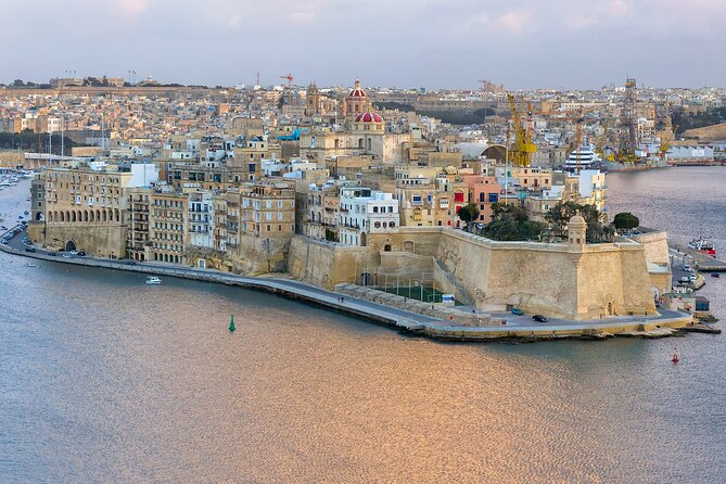
One of the highlights is the pass by Valletta Grand Harbour. This is Malta’s principal maritime gateway, separating Valletta from Vittoriosa, Senglea, and Cospicua.
The scale is what hits you. Grand Harbour is wide, and the coastline on both sides feels built for navigation and power. It’s been active for over two thousand years, and the harbor layout shows why it became a magnet for ships and trade.
If you love architecture but also love clear spatial understanding, this is one of the most satisfying portions. You’re not just seeing buildings—you’re seeing how the harbor connects communities.
Marsamxett Harbour and the shipyard creeks: leisure and industry side by side
The cruise then passes Marsamxett Harbour, which historically is more about leisure use than the Grand Harbour. You’ll feel that shift as you look across calmer water and more local shoreline edges.
Next comes the area around the Malta Ship Building Yard, including the inner basin and creeks like Menqa and Marsa. You’re no longer in postcard mode. You’re in the working coastal zone.
What this adds for you: it prevents the cruise from feeling one-note. Malta isn’t only fortresses and historic cities. It’s also the place where ships are built and maintained, where maritime industry sits just a few minutes away from scenic promenades.
Even if you’re not into ships, these industrial passes give the day realism. Malta feels like a living place, not a museum with boats.
The French and Dockyard creeks: a working coastline tour
The cruise also goes through the French and Dockyard Creeks. Even without stopping on land, you’re getting a view of how maritime infrastructure wraps around the harbors. It helps you understand that Malta’s coastline is engineered for movement, storage, and protection.
This section can be less dramatic than the fort-wall views, but it’s useful. If you’re the type who likes to know what you’re looking at, keep an eye out for the geometry of docks and how shore areas change as you shift from one harbor segment to another.
The Three Cities from the water: Cospicua, Senglea, and Vittoriosa
Now for one of the most rewarding parts: the boat passes Cospicua, then Senglea, then Vittoriosa—part of the famous group called The Three Cities.
What makes this area special is that it’s older in a different way. The Three Cities can be described as Malta’s “cradle” of settlement, and the supplied context is clear:
- Their harbor inlets were used since Phoenician times
- Docks supported local life but left areas vulnerable during wars
- When the Knights of St. John arrived, these were their early home bases
- Their palaces, churches, forts, and bastions are said to be older than Valletta’s
From the water, those statements become easier to believe. You’re not guessing the layout—you see fortifications pressed right up against the harbor edges. You also understand why these cities grew where they did: water access shaped both daily life and defense.
If you want a quick “orientation layer” for later walking, this is it. You’ll likely recognize streets and waterfront angles later when you’re on land.
Kalkara and Rinella: quieter creeks before the return to Sliema
As the cruise nears the end, you pass through Kalkara Creek, described as the second creek to the port side on entering Grand Harbour, with a picturesque village overlooking the bay.
Then it’s Rinella Creek, the first creek on the port side when entering Grand Harbour. One of the facts worth keeping in mind: there’s a small sandy beach at the extreme end.
These final segments can feel more relaxed than the fortifications and city passes. They’re a good time to just take in the shoreline variety. And if you’re sitting near the open air, the cruise often feels like it’s wrapping in a calmer mood before heading back to Sliema Ferries.
Comfort, seating, and the quality of the English audio
This is an audio-guided cruise using a PA system. There isn’t a live guide listed as included, so the narration is the “person in your ear,” and it’s part of what people seem to value most.
The English commentary is described as helpful and specific, pointing out places of interest and explaining history as you pass. One review specifically praised commentary by Robert. That’s a good sign if you want your landmarks connected to meaning rather than just seen.
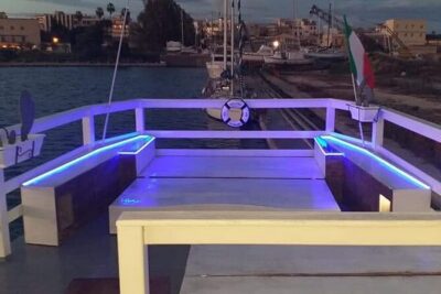
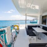
Seating is where you can personalize the experience. On breezy days, open-air seating can feel invigorating—or a little intense. If you’re worried about cold, keep in mind that the boat can feel chilly in cooler months. Layers help. A small blanket can also make a difference when the wind is doing wind things.
If you can, try to sit where you get the clearest sightlines. Outside seating tends to offer the best view, and there’s usually room to move around to find sun or shade depending on the conditions.
Price and value: is $24.19 for 90 minutes worth it
For $24.19 per person, you’re buying three things:
1) A boat ride that covers lots of coastline in a short window
2) English audio commentary to turn views into context
3) A central return to Sliema, so the outing doesn’t strand you
Compared with spending half a day getting transportation around multiple sites, this offers a clean “time-to-sights” ratio. You’re also getting perspective you can’t replicate from the road. Fortifications and harbors are designed for movement through water, so seeing them from the water is not a nice-to-have. It’s the whole point.
It’s also a low-stress way to cover a lot if you’re traveling with different interests. Someone who loves cities gets the Three Cities and Valletta edges. Someone who likes scenery gets the creeks and harbor geometry. Someone who just wants an easy afternoon gets a relaxing cruise with long enough gaps to enjoy the view.
Who should book this (and who should think twice)
This cruise is a strong fit if you:
- Want a short, high-impact Malta viewpoint
- Prefer guided-style context without booking separate museum time
- Like harbors, cities, and architecture, especially when seen from the water
- Are trying to get your bearings between Valletta and Sliema zones
You might think twice if:
- You’re prone to sea sickness. This tour is not recommended for that group.
- Weather looks rough. The experience requires good weather, and wind can make the ride less pleasant.
If you’re flexible and you can choose your day wisely, it’s an easy win for first-timers.
Should you book this harbour-and-creek cruise from Sliema?
I think it’s worth booking if you want a practical Malta highlight that doesn’t hijack your schedule. The route hits the big emotional notes—Manoel Island, the Lazzaretto, Valletta’s fort walls, the Grand Harbour, and the Three Cities—and the English audio keeps you oriented.
If you’re debating between a land day and a short sea day, this is the “short sea day” pick. You’ll leave with a better mental map of the coastline, and that makes the rest of your Malta sightseeing easier.
One last tip: dress for wind, not just sun. Malta’s harbors can feel breezy fast. Bring a layer and choose your seating early, and you’ll get much more out of the views.
FAQ
How long is the Malta harbours and creeks cruise from Sliema?
The cruise runs about 1 hour 15 minutes to 1 hour 30 minutes (approx.).
Where does the cruise depart from?
It departs from Ferries 4Malta in Sliema and returns to the same meeting point.
Is there a live guide on board?
The included experience is a sightseeing cruise with audio commentary over a PA system. A guide is not listed as included.
What language is the audio commentary?
The tour is offered in English.
Is this cruise good if I get sea sick?
It is not recommended if you are prone to sea sickness.
What should I bring for the trip?
You’ll want to dress for the weather on the boat, especially wind. A layer can help, particularly in cooler months.
What happens if the cruise is cancelled due to weather?
This experience requires good weather. If it’s cancelled due to poor weather, you’ll be offered a different date or a full refund.